
 Location of the Dumfries findings on an interactive map of Carriacou.
Dumfries Historical Site.
Here you will find plantation ruins with some old equipment.
See the old machinery that was used in processing cotton and limes.
Below you will see the picture of a stone chimney, which is the most visual ruin.
On the map below you can locate several places of interest.
These include the old Sabazan Well and ruins of the Lime factory.
These include the old Sabazan Well and ruins of the Lime factory.

Map of Dumfries and the points worth to see.
Chimney of the old lime factory.

Chimney from an old lime factory on Carriacou.

Taking a hike on Carriacou towards the Dumfries historical site.
The picture below was taken from up the hill in Belmont.
On the background you see White Island.
The historical site is to the left below.
On the right hand side is the Cassada Bay complex, now a derelict hotel.
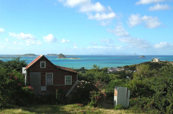
This picture was taken from Belmont, north of Dumfries.