Grenada and Carriacou

Map of Carriacou - Grenada and Carriacou

Menu
Skip to content
MENUMENU
  • Carriacou
    • Diving
    • Fishing trips
    • National parks
    • Nature
      • Hiking
    • Sailing
      • The Grenadines
    • Transport
  • Guides
    • Bars - rumshops
    • Car rentals
    • Healthcare
    • Lawyers
    • Restaurants
    • Shops
  • History
    • Arawaks
    • Belair
    • Colonialism
    • Grenada History
    • Garifuna
    • Grenada Revolution
      • Grenada 17
      • Maurice Bishop
    • Windward
  • Hurricane Beryl
  • Lodging
    • Apartments
    • Guesthouses
    • Hotels
    • Villas - cottages
  • Photo Gallery
    • Video

Guides » Carriacou in the Grenadines. » Map of Carriacou

Please note that most businesses have sustained heavy damage due to hurricane Beryl.
Therefore many shops and lodging facilities will not be opened or are in the process of reopening.
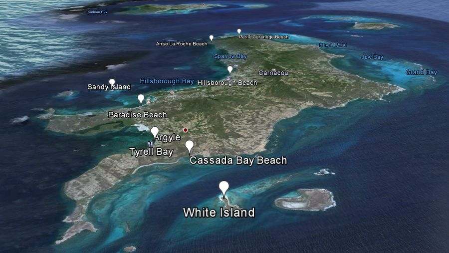
Map of Carriacou

Carriacou in the Grenadines..
← Previous Next →
Carriacou Union Island and Tobago Cays.

Carriacou with top left Union Island and top-right the Tobago Cays.

Above Carriacou on the left Union Island, on the top right are the Tobago Cays.


Previous: History of Carriacou from precolombian times till recent years.
Next: Carriacou in the Grenadines.