Tag Archives: Ruins

Cleaning of the Ningo Well in Tibeau.

In Tibeau is the Ningo Well.

Geotag Icon See this location on the interactive map of Carriacou.
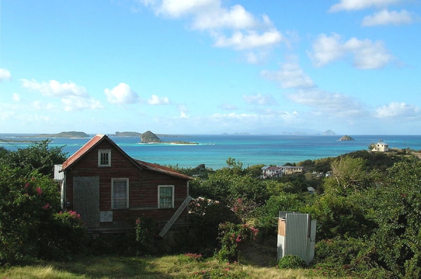
The old Well in Tibeau.

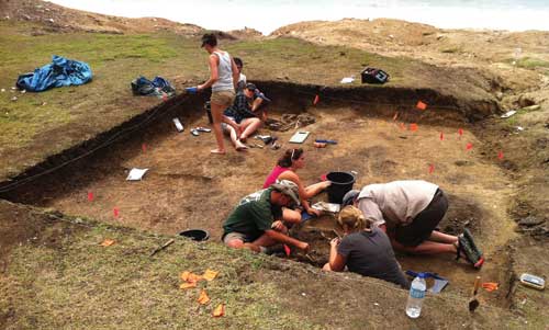
In Jews Bay, just above the archeological findings at the fossil beds in Grand Bay.

One of the earliest wells built on the island, and located in the village of Tibeau.
It had been neglected for quite some time.
Now the government is organising a thorough cleanup plus enhancement of the zone.

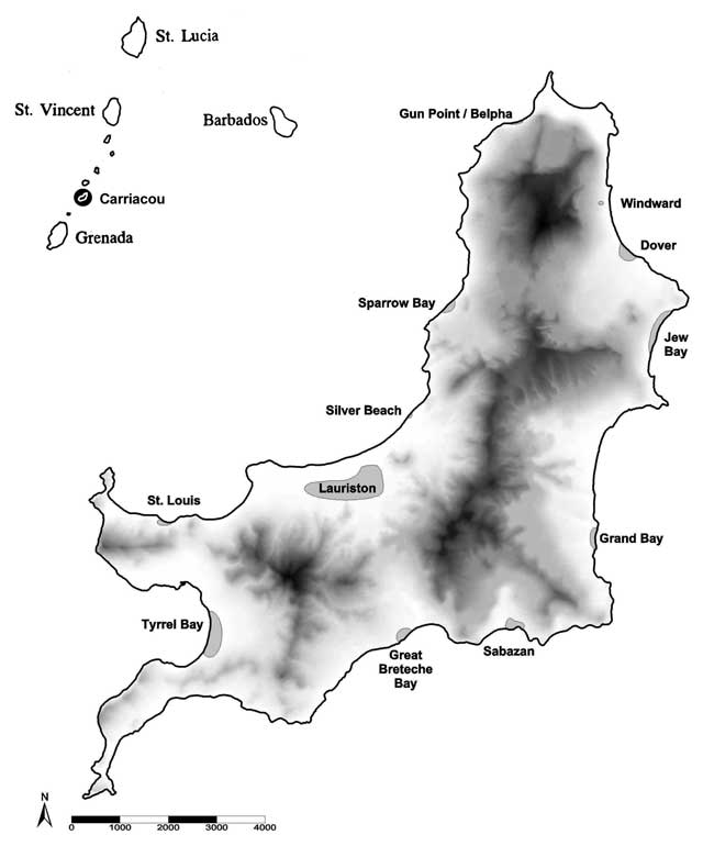
Sites for archeology on Carriacou.

The map below shows the zone south of the well, this is where the fossil beds are.

Fossils and archeological findings on Carriacou.

Archeology at Grand Bay and Jews Bay on Carriacou windward side.

At the shore close to this well is the Tibeau cemetery.
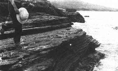
This burial ground has collapsed in the ocean with very few graves remaining.
  • Another interesting place are the ruins in the south, at Sabazan.
  • Check the historical site at Dumfries as well.
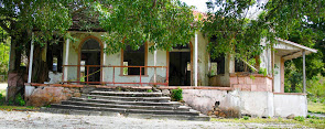
  • Another place of historical interest is the Belair zone, where ruins of the oldest plantation house can be found.
Historical site Sabazan on Carriacou.

Sabazan Ruins.

Geotag Icon Location of this historical location on the map of Carriacou.

Ruins at the Sabazan historical site.

Archeological findings on Carriacou.

Old burial site on Carriacou.

Sabazan was probably the most elaborate of the large estate houses on Carriacou.
Constructed in the late 1700’s or early 1800’s the ruins contain an old well, six foundations, a tower looking towards the sea and an elaborate cistern system.

The ruins reflect the history of agricultural development and the importance of water in Carriacou.
It is a site of an important Amerindian settlement.

Dumfries.
Nearby, at Dumfries is an old Cotton gin, lime factory and French foundation.
It is the home of some rare birds, e.g. the mangrove cuckoo.

Some suggestions for protection and conservation.

  1. To protect the ruins, artifacts, birds; to design programs of educational research to further understand the historical development of Carriacou.
  2. To tie in Sabazan, Dumfries, and other protected areas into an around the Island tour for visitors and school groups.
Historical site Sabazan on Carriacou.

Sabazan protected area of Carriacou.

Map of the archeologial findings on Carriacou.
Map of Carriacou with archeological findings.

Carriacou history and important historical locations.


Grand bay fossil bed location.

Grand Bay Fossil site, archeology on Carriacou.

Geotag Icon Location of the archeological findings on a map of Carriacou.

The fossil beds in Grand Bay.

Archeologists uncovering part of the site.

Finding human remains at Grand Bay.

Location: 1/2 mile south and 1/2 mile north of Grand Bay Village.
On the Windward Coast of Carriacou.

Both sites contain about 30 feet of well bedded fine grained ashy shales which are exposed along the shore.

Fossils of Gastenopoda, Pleurotoma, Alvitra, Phos, Pyrala and Conus are present.

When wet with seawater, the fossils look very well preserved.
In some cases, the sharp edged angite crystals have imprints.
Trocolyathus and Flabellum can also be seen.
Fossils in the open air, clearly visible.

Tibeau fossil beds at the coastline.

The Globorotalia Fobsifobsi (Grand Bay Beds) have been correlated with the Lower Miocene Baitoa formation of the Dominican Republic.

The fossil beds are the only known beds in Grenada which are plainly visible.

The beds provide excellent opportunities for education, illustrating prehistoric shellfish, some of which are long since extinct.

Grand bay fossil bed location.

Protected area where the fossil beds are on Carriacou.

Belair estate house while used by the peoples revolutionary army.

Belair cultural and historic area.

The Belair historical site.

The Belair Cultural Landscape once served as a headquarters for the People’s Revolutionary Army.
If you are interested, read more about the Grenada Revolution.

Ruins of the Belair Great House.

Remains of the great house plantation in Belair.

Historically the property was cultivated in sugar cane and thereafter cotton.
Sugar cane windmill ruin on Carriacou.

Belair Carriacou, windmill for sugar cane.

In 1784, John Reid, Esq. owned Belair Estate.

An old English great house was completed in 1809. Next to the great house, foundations of an older French house exist, indicative of the amount of times the island of Carriacou changed hands.

The house looks upon the old windmill tower still in excellent condition.

At one time the entire area was cultivated in sugar cane to support the mill.
Thereafter, at the turn of the century, cotton became the predominate crop.

Ruins of the Belair estate.

This is the zone where Belair house ruins are.

Just down the road is an old windmill foundation which is so intact it could be restored.

Belair estate house while used by the peoples revolutionary army.

Belair house during the Grenada Revolution.

During the People’s Revolutionary Government, the area was utilized as an Army Camp.

At the time of the U.S. and Caribbean Forces intervention of Grenada, a large explosion occurred at the house which remains a mystery.

Belair has both French and English ruins, and the finest sugar mill and windmill foundations on the Island.
A large cistern is also in place.

The Belair Estate affords one of the most spectacular views on the island.
To protect the ruins and initiate programs of education and research.

Possible restoration plans.

Frances Kay Brinkley of the Historical Society has recommended that the Belair house be restored to a cultural and conference center.
Funding agencies and private sector initiatives should be sought out to restore the house.

Dumfries historical site map.

Dumfries Historical site and ruins.

Geotag Icon Location of the Dumfries findings on an interactive map of Carriacou.
Dumfries Historical Site.

Here you will find plantation ruins with some old equipment.
See the old machinery that was used in processing cotton and limes.
Below you will see the picture of a stone chimney, which is the most visual ruin.

On the map below you can locate several places of interest.
These include the old Sabazan Well and ruins of the Lime factory.
Dumfries historical site map.

Map of Dumfries and the points worth to see.

Chimney of the old lime factory.

Chimney ruin in Dumfries - Carriacou.

Chimney from an old lime factory on Carriacou.

Path to Dumfries.

Taking a hike on Carriacou towards the Dumfries historical site.

The picture below was taken from up the hill in Belmont.

On the background you see White Island.
The historical site is to the left below.
On the right hand side is the Cassada Bay complex, now a derelict hotel.

On the background white island, more on the foreground is Dumfries.

This picture was taken from Belmont, north of Dumfries.